
Wednesday
Arts and PoetryLandscape as Sacred Map
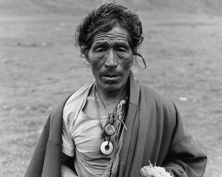
Pilgrim, Tibet
A Photographic Journey into the Heart of the Himalayas
by David Zurick, Berea, Kentucky
In 2004 I began traveling in the Himalaya and Tibet with a large-format camera and sheet film to make black-and-white photographs of sacred places in the region: monasteries, shrines, and temples; scriptural carvings on rocks; prayer flags; the sources or confluences of holy rivers; revered mountains; forest sanctuaries and hidden treasure valleys; and numerous other consecrated elements in the landscape.
These spiritual features populate the rugged terrain and are among its most remarkable cultural imprints. I was interested in how they might illuminate a particular way of seeing the world. My photographs in this project center upon places of a religious or spiritual character, and thus foremost engage with human ideas about sanctified nature; a sense of place; networks of worship, religious transmission, and learning; sacred architectures; and, inevitably, about changes that overcome places with the passage of time. Photographing a religious site in this vein is not simply a matter of taking a picture of holy scenery — rather, it is akin to delving into a rich repository of landscape meaning.
During the course of the project, I came to understand sacred geography as a kind of mythic cartography, wherein the abstract coordinates of latitude and longitude one commonly finds on a map are replaced with markers on the Earth’s surface that delineate a cosmological organization of the world. Geographers refer to ideal or imaginary cartograms as mental maps — images of the world we hold in our minds. They take form as we navigate life and are influenced by our personal experiences and cultural backgrounds. They help us make sense of the world.
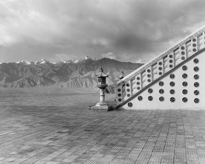
The Sanskrit concept of mandala, which permeates the religious traditions of Tibet and the Himalaya, is one such kind of mental map. It imagines a celestial realm on Earth that may be physically imprinted as a temple wall mural, a sculpture or architecture, a sand painting, or, in the case of sacred geography, a terrain filled with known and revered spiritual places. This transposition of religious thought to the landscape extends the planet’s surface to the empyrean. It engages the natural elements, a sense of place, and networks of movement and circulation that assemble the sacred sites into a comprehensive worldview. In such ways, and for some people, the world is made holy and the landscape becomes a touchstone for a reverent calculation of life on Earth.
The Buddhist, Hindu, pre-Buddhist Bon, and Shamanic traditions of Tibet and the Himalaya all pay special homage to places that are deemed spiritually powerful by virtue of their unique geographical qualities. Such places often have physical lineaments: a summit where the sky meets the land in a kind of axis mundi connecting heaven and Earth; the confluence of two or more rivers; a cave; a hot springs where fire meets water; or the upwelling source of a river. Spiritual practice transforms such geomorphological settings into auspicious sites.

Sacred Lake (Yilhun Lhatso), Tibet
In these ways, geography and faith combine to provide one with an enduring sense of place in the topography of Tibet and the Himalaya. Abode of deities, the mountains also are home to humankind. In making geography sacred, people strive to create meaningful and safe places to live amid the powerful forces of nature by etching the landscape with the inscriptions of human consciousness.
When I first went about making photographs in landscapes containing such elements, I imagined them to be a kind of portal into the systems of belief from which they sprang — not literal thresholds into a supernatural realm, as might be imagined in some arcane religious practices, or even as simple religious scenery, but rather as revelatory of how a people or society might understand life and the natural world. I later came to realize, in my selection of places to photograph — their angles of repose, quality of light, evocations, and so forth — that I also was engaged with my own personal appraisal of sacred places in Tibet and the Himalaya. I, too, was embarked on a kind of spiritual journey — a picture pilgrimage.
Shanti Stupa, India
While it might arise from the mental coordinates of faith or ritual practice, sacred geography in Tibet and the Himalaya is anchored to tangible places and abides the transformations in the landscape that occur alongside the broader shifts in society. It is testimony to the resiliency of faith in the region that so many sacred places remain significant to so many kinds of persons. Despite their visible alterations or the social and environmental dislocations that may arise among their cultural settings, the sacred landscapes remind us that we live together in a world of mystery and beauty, where the human spirit is in synchronicity with natural forces.
~~
 Text and photographs excerpted from the book, Land of Pure Vision: The Sacred Geography of Tibet and the Himalaya by David Zurick (2014).
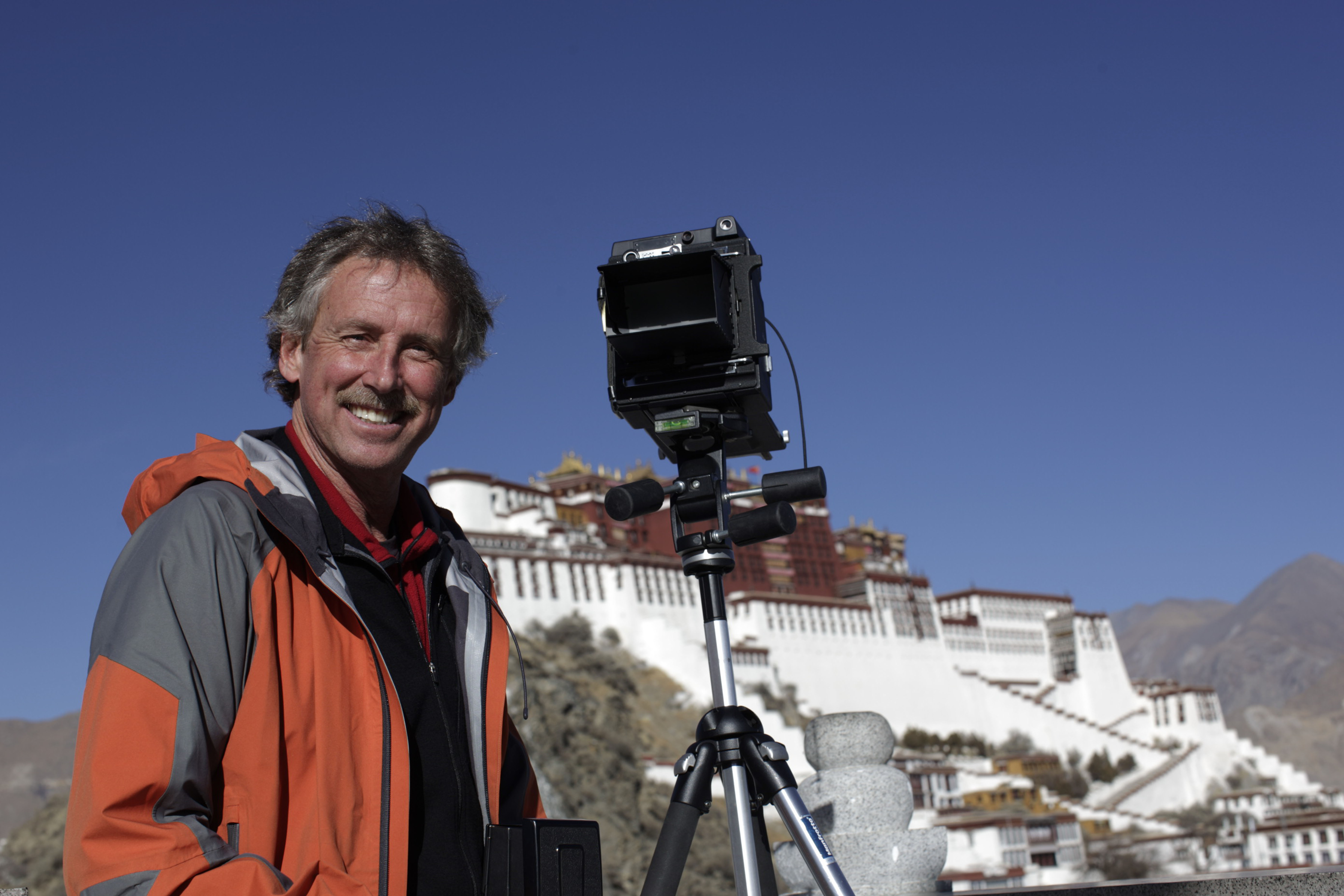
David Zurick makes photographs with a 4×5 vintage camera, and develops film and makes prints in his darkroom at home. His work appears in numerous books and other publications and is internationally recognized. He is the winner of the Mountain Book Award, the recipient of the Mount Everest Award, and a two-time recipient of the Al Smith Visual Artist Fellowship from the Kentucky Arts Council.


Sep 8, 2014
Reply
Hi David,
Wonderful to see your work, and look forward to reading it and seeing it. I have been working along the same lines for the pas twenty five years with the Mi’kmaq first Nations of Easter Canada looking at the language, place names and sites, songs, dances, etc. and showing them as mirrors and maps of the many see as the “physical environment”, though it was, and still is, inseparable from their cultural psyche. I worked with a Mi’kmaw linguist to co-author a book called “The Language of this Land, Mi’kma’ki” as well as other articles about Legends as Maps, and am involved in a large, digital atlas and website place names project. My thoughts have often been on Tibet having travelled to Bhutan as well and visited sacred sites there, not to mention being deeply influence by my Tibetan Buddhist practice and study.
I do not know where Berea is, but my daughter recently married a Kentuckian, so perhaps we could talk sometime if I make it there, or you to Halifax.
Good luck with your work
Trudy Sable, Phd
Halifax, N.S.